
XAG M2000
Remote Sensing Drone
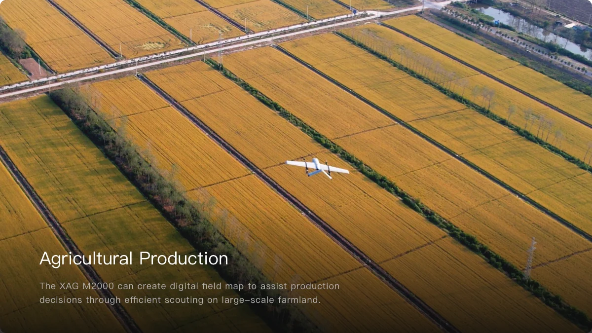
With the fixed-wing VTOL design, XAG M2000 Remote Sensing Drone is developed for high frequency and high demand aerial survey tasks of multiple scenarios, which allows one person to map fields of 533 hectares in an hour¹. Equipped with XAG SuperX 4 Pro Intelligent Control System, the XAG M2000 is capable of accessing quality geographic data, which helps build up digital field maps stably and rapidly to facilitate production decisions.
VTOL For Flexible and Efficient Flight
The quick assembly XAG M2000 can be immediately deployed for operations. The combination structure of multiple rotors and fixed wings allows flexible take-off and landing. 3 kg EPP fuselage plus the high-energy-density battery provide up to 90 minutes flight time and a range of 86 kilometers in a single flight.
Accurate & Autonomous Flight
RTK Centimetre-Level Positioning
Automated Flight Planning
Sophisticated & Stable Imaging
XCam 20MP Pro Gimbal Camera
XCam 26MP APS-C Gimbal Camera
XCam 20H Hybrid Gimbal Camera
XCam 20M Multispectral Gimbal Camera
Flexible Take-off and Landing
Fixed-Wing VTOL Design
Quick Release Body
Safe & Efficient Images Stitching
Cluster Cloud Computing with Encryption
Post Processed Kinematic
Outsmart, Outperform, Outsprint
Longer Battery Life, Higher Efficiency
Cameras To Multi-application, Fast Switch
Featured with 3-axis mechanical stabilized gimbal and mechanical shutter max out at 1/2000 sec., all cameras can take photos at high- speed without rolling shutter effect. Anti-distortion and autofocus lens contributes to high-resolution imaging.
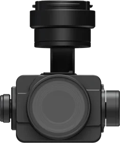
XCam 20MP Pro Gimbal Camera
· 20 MP 1" CMOS Sensor, high-resolution imaging
· DSLR-level ISP, ensures high image quality
· Ground Control Point-Free
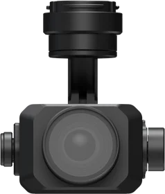
XCam 26MP APS-C Gimbal Camera⁹
· 26 MP APS-C CMOS Sensor, better image quality
· Photos in Five Directions, supports 3D modeling
· 0.4s Shooting Interval, improve mapping efficiency
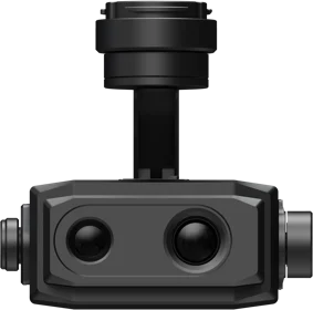
XCam 20H Hybrid Gimbal Camera¹⁰
· Infrared & 20 MP 1" CMOS Sensor
· Temperature measurement at ±3℃ accuracy
· Support HD map and thermal map stitching
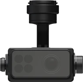
XCam 20M Multispectral Gimbal Camera¹¹
· 20 MP 1" CMOS Sensor & 4-Channel Multispectral
Sensor, pixel-level image registration
· Automatic Sunlight Compensation leads to more
accurate spectrum data (*currently this function is
not supported)
· Real-time NDVI Video reveals abnormality
Easy Flight Planning, Easy Mapping
Field Mapping
HD map
Oblique Photography
3D map
Strip Mapping
River & roadway inspection
Diverse Application Scenarios, Infinite Possibilities
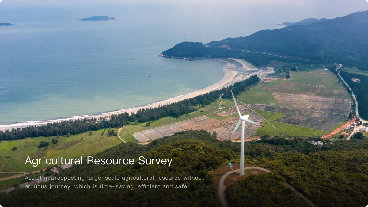

Vision to Digital Farmland
Aircraft
Max Ascent Velocity
≤5 m/s (Fixed Wing)
≤3 m/s (Multi-rotor)
Max Descent Velocity
3.5 m/s (Fixed Wing)
2 m/s (Multi-rotor)
Cruise speed (Typical)
15 m/s
Max Horizontal Speed
22 m/s
Max Takeoff Altitude
6000 m
Max Wind Speed Resistance
8 m/s
Flight Duration
90 Minutes
(Without carrying any payload)
Actural flight duration subjected to
operation conditions
Maximum Takeoff Weight
3500 g
Maximum Cruising Height
400 m
Operating Frequency
2.400 GHz to 2.483 GHz
5.725 GHz to 5.850 GHz
Operating Temperature
-10 ~ 40℃
Sensing System
Downward Radar
Ranging Distance: ≤ 300 m
GNSS
Sensitive Single-frequency GNSS
GPS+BeiDou+Galileo (Asia)
GPS+GLONASS+Galileo (Other Regions)
Multi-frequency and Multi-system
High Precision RTK GNSS
Frequency
GPS: L1/L2; GLONASS: L1/L2; BeiDou: B1/B2; Galileo: E1/E5b
Cold Start Period
< 50 s
Positioning Accuracy
Vertical: 1.5 cm + 1 ppm (RMS)
Horizontal: 1 cm + 1 ppm (RMS)
1 ppm means error increases by 1 mm
as the aircraft moves every 1 km
Data Transmission
Distance of Data Transmission
5 km
Distance of Video Transmission
3 km
Camera
XAG XCam 20MP Pro Gimbal Camera
Image Sensor
1 inch CMOS Sensor
2.4 μm pixel size
Lens
Focal Length 10.6 mm (Equivalent 28.6 mm)
ISO Range
100 - 3200
Shutter Speed Range
1/30 - 1/2000 s (Mechanical)
1/30 - 1/4000 s (Electronic)
Image Size
5472 × 3648(3:2), 4864 × 3648(4:3)
Mechanical Gimbal
3-Axis
Gimbal Pitch Range
-90° to +20°
Max Controllable Angular Speed
90°/s
Gimbal Angle Accuracy
± 0.05°
Operating Temperature
0 ~ 40℃
XAG XCam 26MP APS-C Gimbal Camera
Image Sensor
APS-C
3.76 μm pixel size
Lens
Focal Length: 25 mm (Equivalent 40 mm)
f/5.6
Angle of View: D=59.5°, H=51°, V=38.5°
ISO Range
100 - 3200
Shutter Speed Range
1/30 - 1/2000 s (Mechanical)
1/30 - 1/4000 s (Electronic)
Image Size
6144 × 4096
Operating Temperature
0 ~ 40℃
XAG XCam 20M Multispectral Gimbal Camera
Image Sensor
1 inch CMOS Sensor
2.4 μm pixel size
Lens
Focal Length 10.2 mm (Equivalent 27.5 mm)
ISO Range
100 - 3200
Shutter Speed Range
1/30 - 1/2000 s (Mechanical)
1/30 - 1/4000 s (Electronic)
RGB Image Size
5472 × 3648(3:2)
Multi-spectural Sensors
1/4 inch, 3 μm pixel size
1/30 - 1/4000 s (Electronic)
Wavelengths
Green: 550 ± 15 nm
Red: 660 ± 15 nm
REG: 735 ± 10 nm
NIR: 790 ± 15 nm
Multi-spectural Image Size
1280 × 720
Operating Temperature
0 ~ 40℃
XAG XCam 20H Hybrid Gimbal Camera
Image Sensor
1 inch CMOS Sensor
2.4 μm pixel size
Lens
Focal Length: 10.2 mm (Equivalent 27.5 mm)
f/2.8 - f/11
Angle of View: D=154°, H=90°, V=64°
ISO Range
100 - 3200
Shutter Speed Range
1/30 - 1/2000 s (Mechanical)
1/30 - 1/4000 s (Electronic)
RGB Image Size
5472 × 3648(3:2)
IR Sensor Type
Vanadium Oxide Infrared Sensor
IR Lens
Focal Length 9.1 mm
f/1.2
Angle of View: H=48°, V=38°
IR Wavelength Range
8~14 μm
IR Image Type
Monochrome/Pseudo Color
Temperature Measure Range
-20 ~ 150℃/0 ~ 550℃
Temperature Measure Accuracy
± 3℃
Operating Temperature
0 ~ 40℃
FPV Camera
Image Sensor
1/2.9 inch CMOS Sensor
2.8 μm pixel size
Lens
Focal Length: 4.79 mm f/2.8 Angle of View: D=144.8°, H=116°, V=60°
Video Resolution
1080P/720P
XAG SRC1 Smart Remote Controller
Display Screen
5.5 inch (1920 × 1080)
Max Signal Range
(No Interference/Obstruction)
Video Transmission: 3 km
Data Transmission: 5 km
Battery Life
In use: 4~8 hours
On standby: 15 hours
Battery life may vary depending on
usage and settings.
B6180 Smart Battery
Capacity
182.4 Wh
Battery Type
Lithium Polymer Battery
Operating Temperature
10℃ ~ 40℃
Smart Charger
Input Voltage
AC 100-240V~ 50/60Hz
Output Voltage
26 V
Rated Power
300 W